
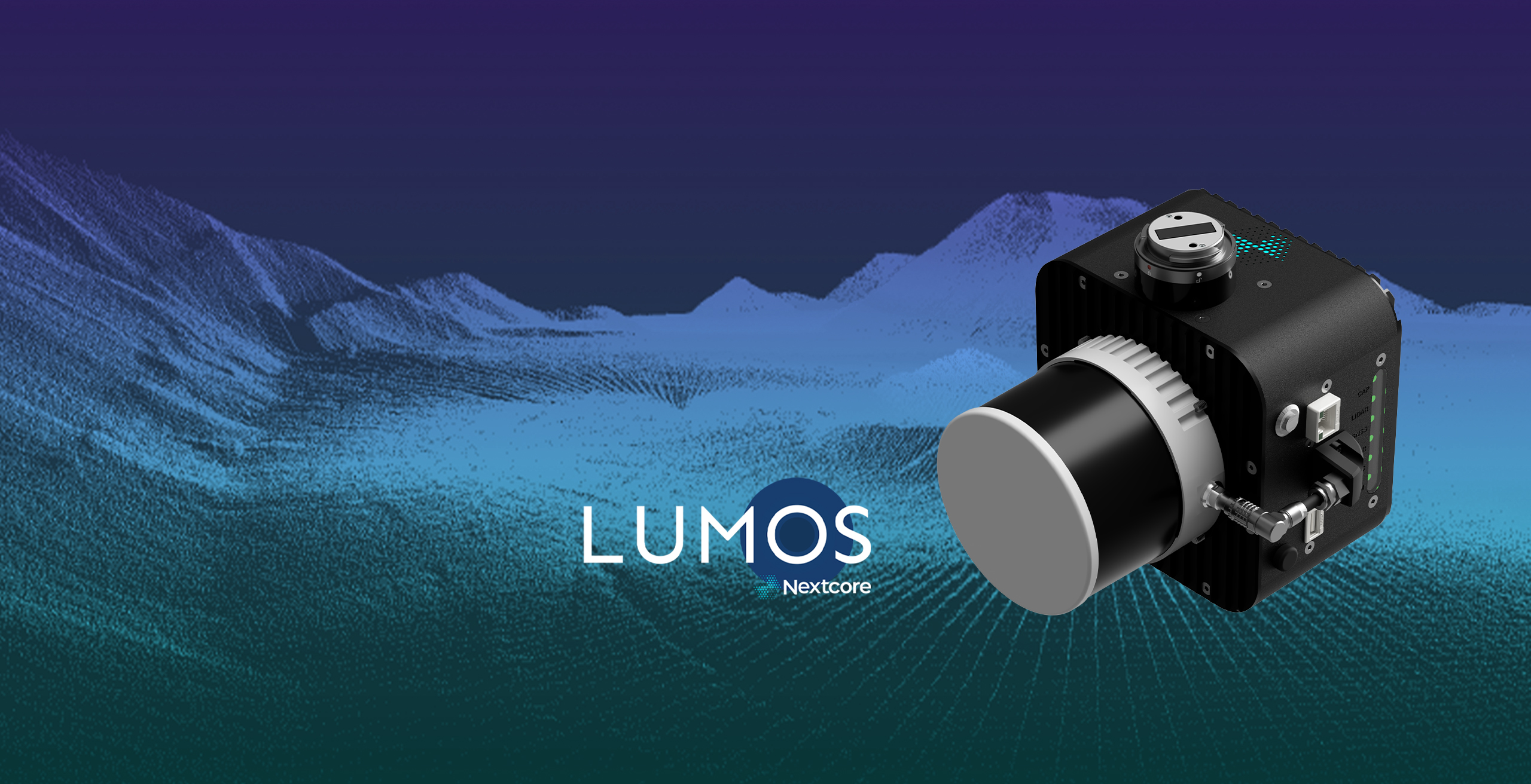
Discover the next generation of UAV LiDAR
Request brochure
Lumos 100XT
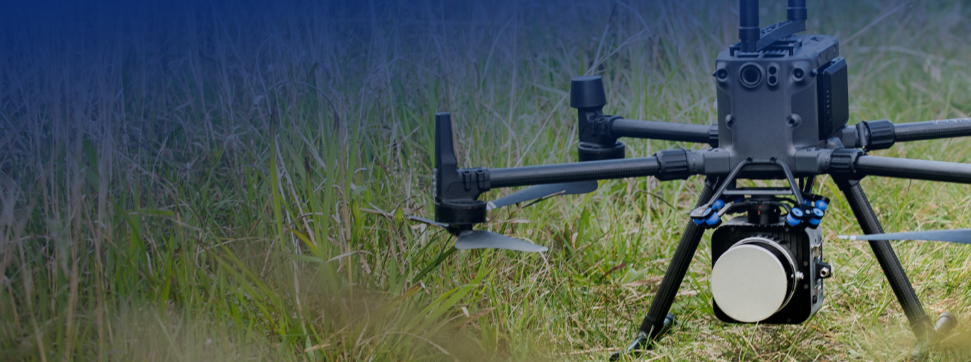
The Nextcore Lumos XT is a perfect blend of reliability, performance and simplicity. The system helps you to greatly reduce time spent in the field and processing in the office. Lumos XT can be mounted to a range of UAVs including the DJI M300, Acecore, Inspired Flight, and can be adapted to many other airframes.
Lumos 120XM
At 1.5kg the Lumos XM is the lightest and most powerful system in the range. It supports triple returns resulting in data collection with high accuracy and greater detail for high-quality survey models. Lumos XM can be flown at greater altitudes and for a longer duration owing to its lightweight design and powerful return accuracy.
Why did we build Lumos?
Our customers wanted:
- A system to fit the DJI m300 UAVs and other popular makes
- A system that would work with a camera to create colourised point clouds
- A lighter system in a smaller case
- Better accuracy
- Better height above the ground, trees and powerlines
- The same, simple workflow
We listened…
What is Lumos?
Our Lumos series consists of two systems both of which can produce 30mm precision and 40mm accuracy at heights up to 120 metres AGL. The system will fit a DJI m300 as well as a broad range of other UAV systems. Weighing between 1.6kg and 1.9kg depending on the system you can produce some of the most precise, reliable data available.

The Lumos Line-up


The Nextcore Lumos 100XT is a perfect blend of reliability, performance and simplicity. The system helps you to greatly reduce time spent in the field and processing in the office. The Lumos 100XT has an accuracy of 40mm. With a great point density, Lumos 100XT can easily collect quality data at 100m AGL with a 130m swath. It weighs just 1.9 kilograms and can be mounted to a range of UAVs including the DJI M300, Acecore, Inspired Flight, and can be adapted to many other airframes.

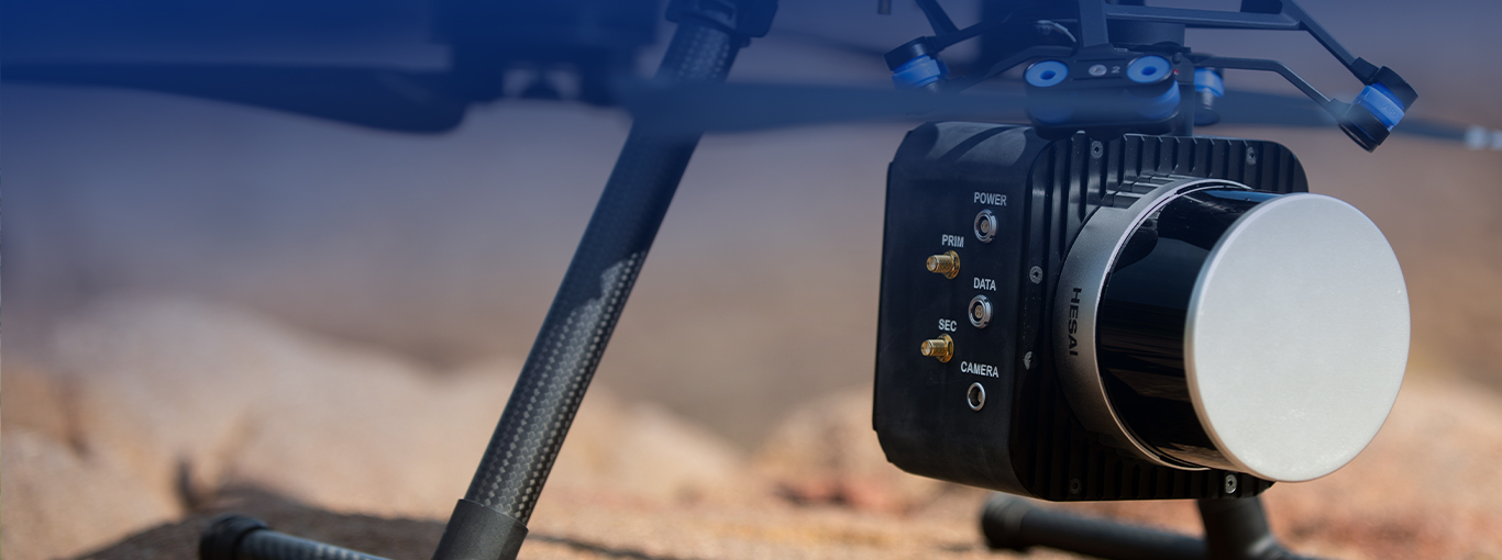
The Nextcore Lumos 120XM UAV LiDAR takes the key features of the Lumos XT but maximises the available flight height of the system. Operating reliably at 120 metres AGL and still achieving excellent ground returns, the Lumos 120XM is the go-to system for high-quality data in rugged, steep and vegetated terrain. The Lumos 120XM gives operators peace of mind when operating above trees and buildings to ensure quality data with plenty of safety margin in challenging conditions.

Lumos vs RN
The Nextcore RN series is renowned for its high-precision UAV LiDAR solutions that are robust, easy to use, trusted and secure. However, the Lumos is an upscale system able to achieve better accuracy at a greater height and lesser mass.
Whilst a lot of focus for UAV LiDAR is on the accuracy, often, other parameters like reflectivity are not given proper consideration. This is a comparison between the RN50 that we launched several years ago and the Lumos XT100. This is a powerful upgrade that can make many tasks easier to achieve.
Applications
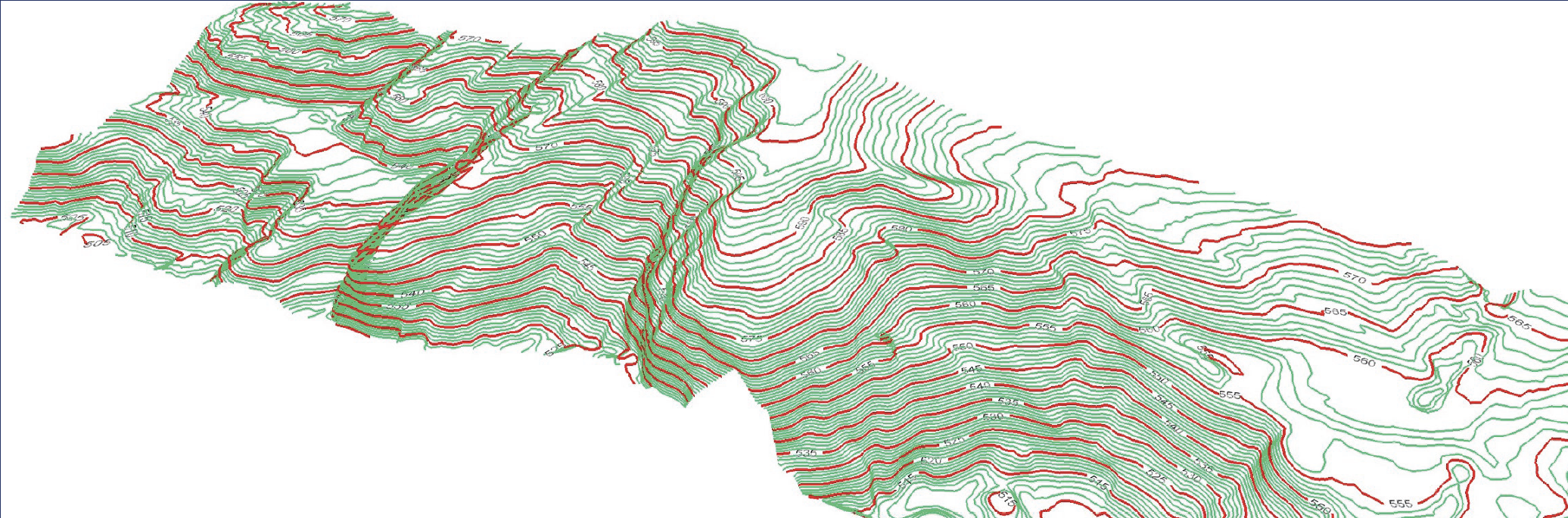
Typography extraction
Areas infeasible by conventional surveying or not possible by other aerial methods can now be captured and processed into surveying deliverables in a safer and more efficient way.
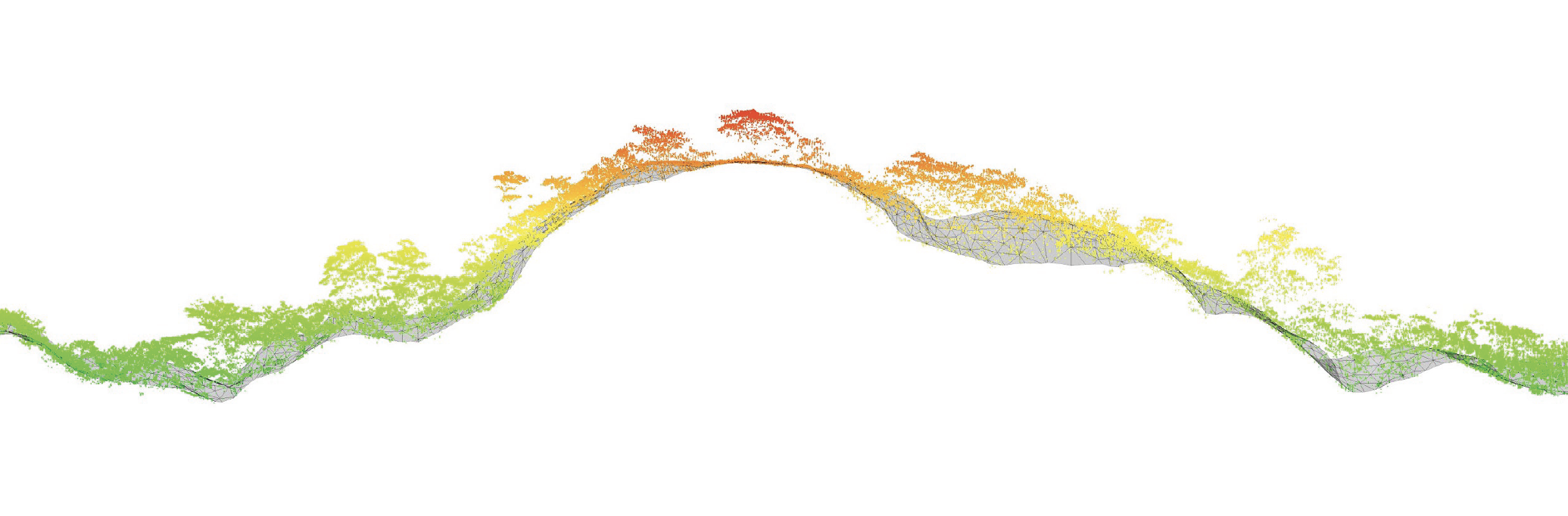
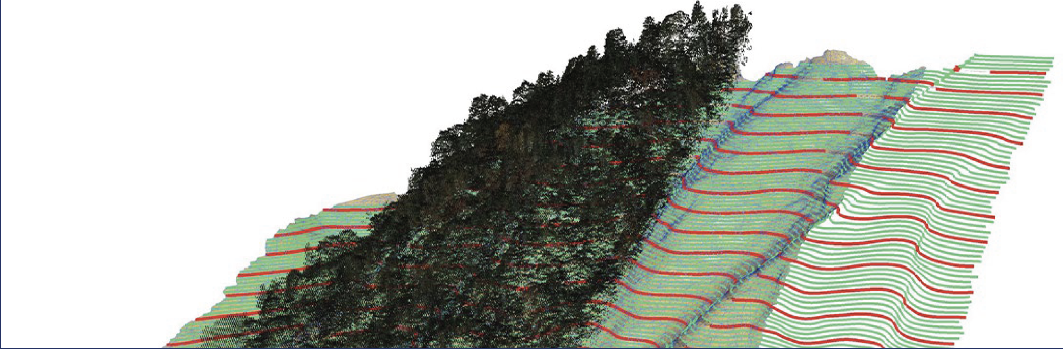
Thick vegetation
Lumos performs well in thick vegetation with two returns in every laser (3 returns for XM).
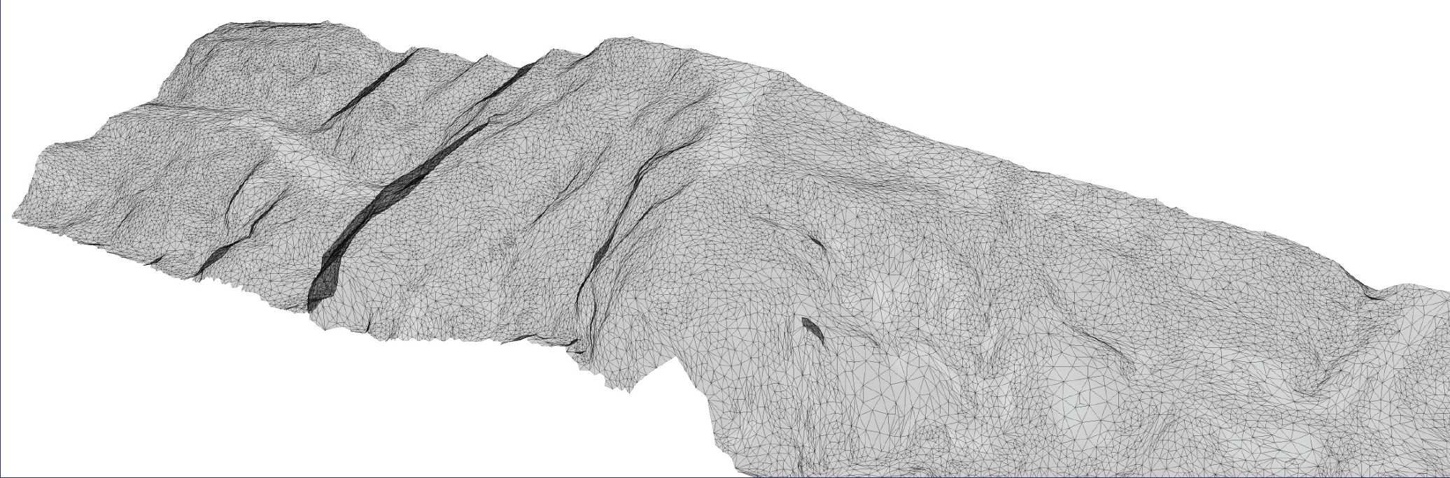
Steep terrain
It is a great tool for capturing survey data for areas that cannot be safely accessed by people.
Forest fire management
Lumos XT can be used to map vegetation density, identify problem areas by fuel mapping & fire behaviour modelling and understand burn success through locating burn lines and by allowing early vegetation intervention.
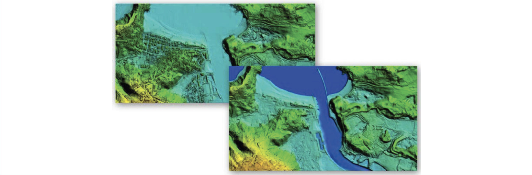
Flood modelling
Lumos helps in determining the probability of flooding for a geographic area by building flood maps, hydrography impact prediction, town planning, state & local government assessments and insurance assessments.
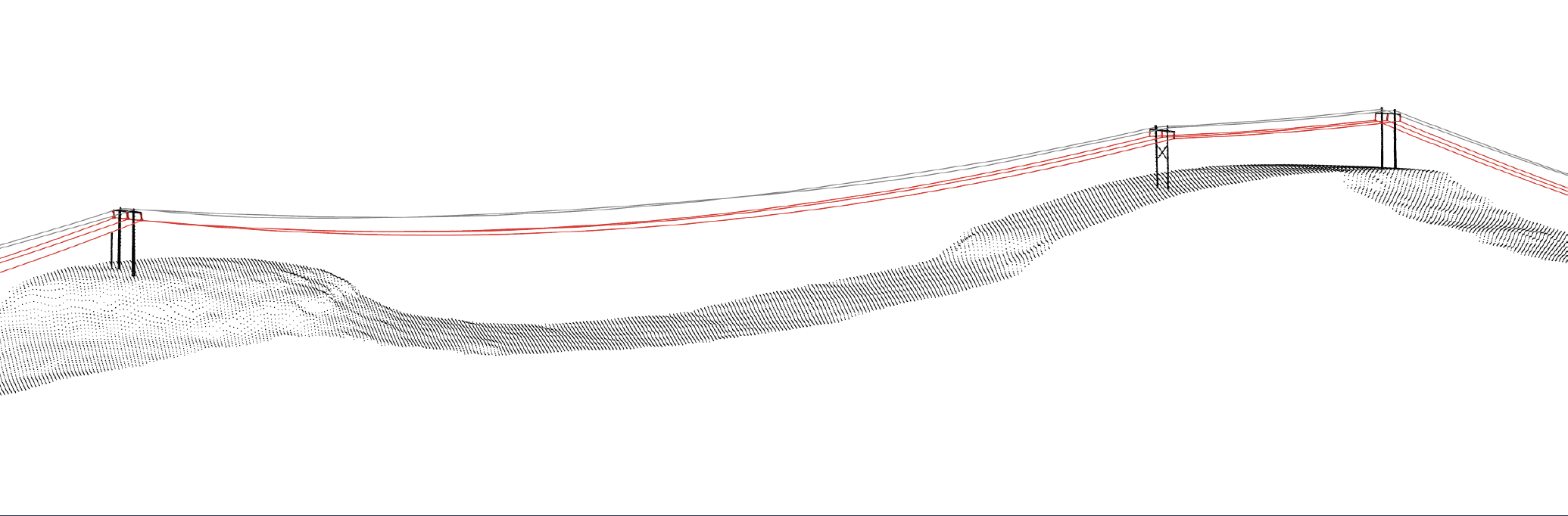
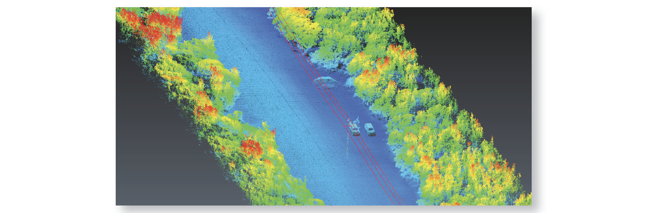
Powerlines
The system allows energy infrastructure data capture that can be processed into valuable surveying deliverables with unmatched efficiency.
Construction
The integration of GNSS and IMU allows Lumos to yield user accuracy down to the centimetre level.
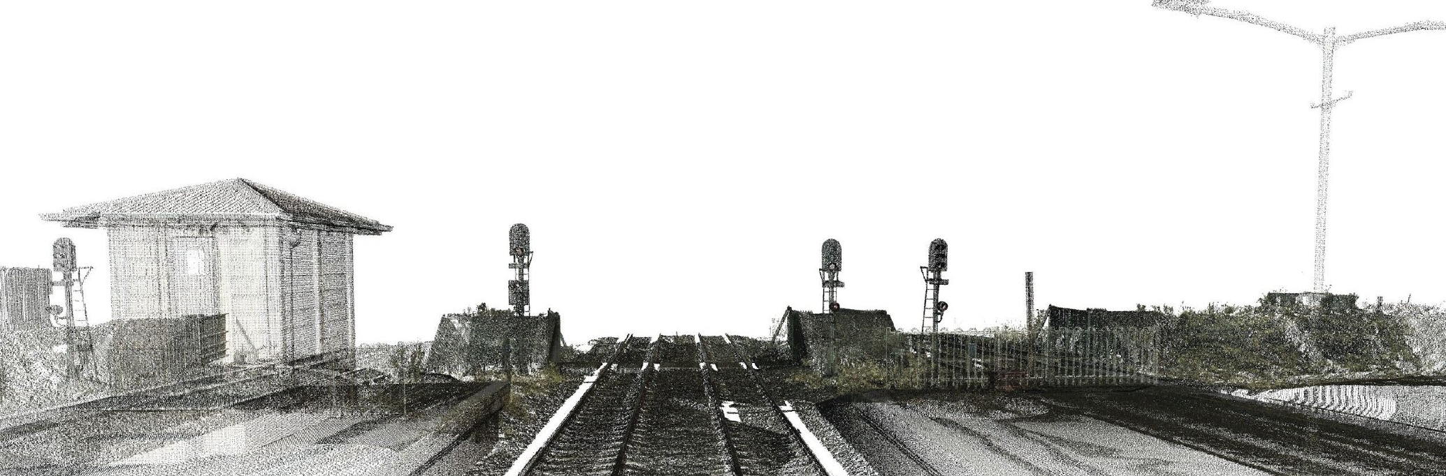
Road Scanning
Lumos provides road management and analysis of road data including digitized pavement data, pavement damages, road conditions and road markings.

Digital Twin inputs
Lumos’ comprehensive aerial sweep and high accuracy from altitude, coupled with the Nextcore fusion software for data extraction, is an ideal source to provide data inputs into Digital Twin systems and spatial programs.
Request the Lumos Brochure

Speak to our expert support team…
We have an expert support team and global network of distributors who can demo our products and discuss your specific project requirements, so use the form below to get in touch or check our distributors list here.