
How does LiDAR Work? LiDAR for Aerial Application
As technology improves, the way we work changes. No industry is this more true for, than Survey. The rise of accurate GPS caused a massive phase shift in how survey work was done. This shift happened again with the mainstream introduction of drone technology with Photogrammetry combined with Ground Control Points, changing the accuracy and quality of survey and mapping data forever.
It is now time for a new phase shift with drone based LiDAR. Much of the survey industry is familiar with LiDAR and some organisations are actively using manned aircraft LiDAR. These are fantastic technologies but have some major limitations, namely, the Terrestrial Laser Scanners provide fantastic detail but can take a long time to capture even small areas and linear assets take even longer. While manned plane lidar allows for the covering of very large areas, it has restrictions in the density of data it can collect and the price can be astronomical for small areas.
Drone LiDAR offers some significant advantages over traditional methods of doing certain jobs. Namely, linear assets, mines, and small and medium land areas, especially if they have dense vegetation can all benefit from UAV mounted LiDAR.
Linear Assets
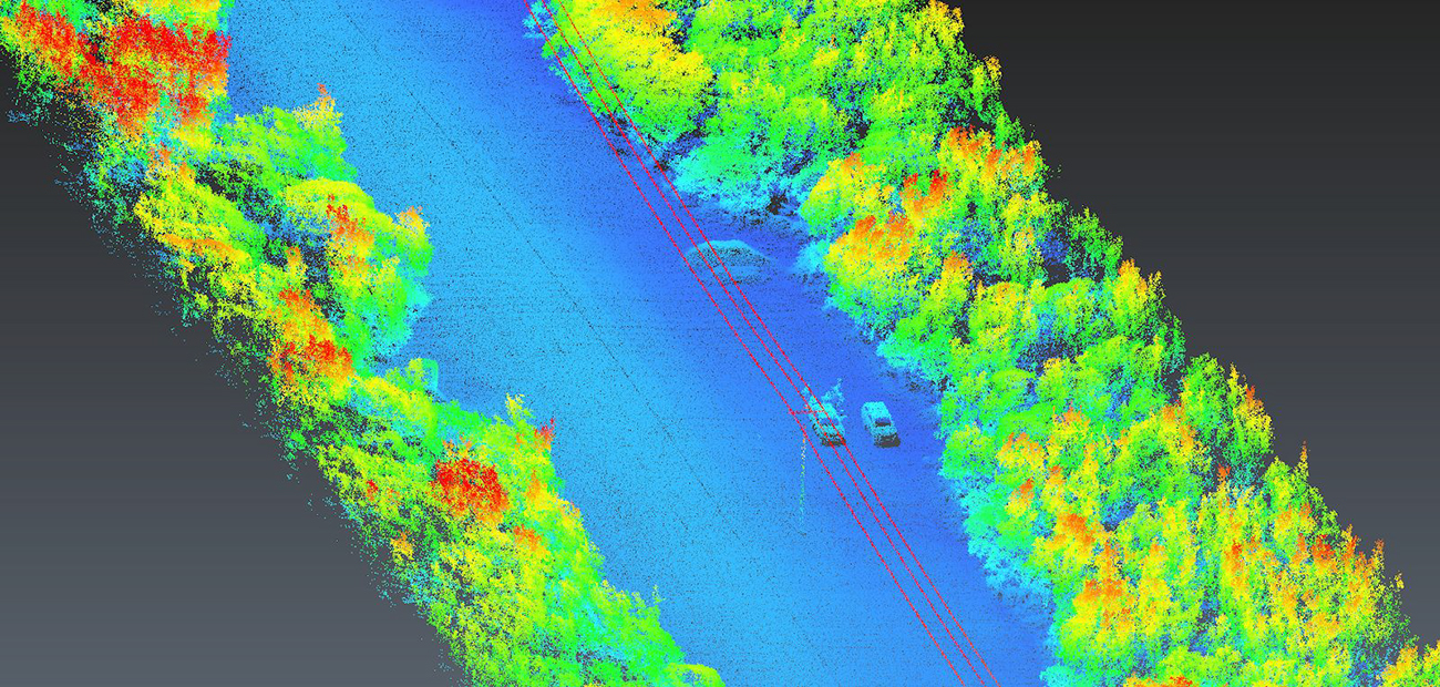
Linear Assets can include anything from road and rail, to pipelines and rivers. These can be very challenging to survey and at the very least involve walking the length at least once, or even flying a wide photogrammetry mission or multiple passes with a plane. Drone LiDAR offers the ability to capture large linear assets with a single pass, and output the data quickly and accurately. This allows for not just a massive efficiency improvement, but a reduction in OH&S risk not to mention a substantial increase in the quality and accuracy of the data.

Mines
Having high quality spatial data available within minutes of landing is a gamechanger for the mining industry and thats exactly what drone LiDAR can offer. With our NextCore platform, you can have an initial point cloud available within 5 minutes of landing, and you can have a post-processed point cloud available in about three times the flight time of the mission. What this means is you can get a pre and post blast scan data back in the office and make decisions off that data within hours of the blast occurring.
Small and Medium Land Areas
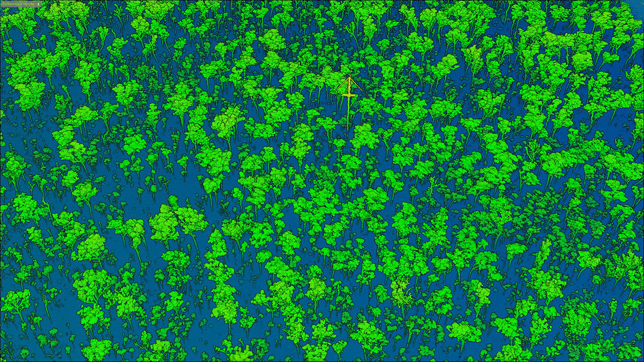
One of the biggest advantages of drone liDAR is with small and medium land survey and mapping. No longer do you have to spend days or weeks trekking through thick trees, struggle to get RTK connection and battling the elements. With the NextCore LiDAR Platform you can easily cover 30 Ha in a single 20 minute flight. This type of job has the added benefit of amazing tree canopy penetration to be able to pull accurate surface models with ease.
Speak to our expert support team…
We have an expert support team and global network of distributors who can demo our products and discuss your specific project requirements, so use the form below to get in touch or check our distributors list here.